Elly
Administrator
Posts: 29,887
|
Post by Elly on Feb 19, 2007 6:58:25 GMT 10
Thanks Neil, loved talking the journey with you, the photos are just wonderful #ssmile# The weather looks pretty mild.
|
|
|
|
Post by smudger on Feb 19, 2007 17:18:08 GMT 10
Neil great pics  , always a pleasure to look at  |
|
|
|
Post by andi on Feb 20, 2007 0:05:02 GMT 10
|
|
|
|
Post by andi on Feb 20, 2007 0:17:14 GMT 10
Aberfoyle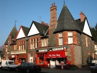 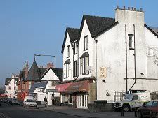 Aberfoyle is a testament to the early power of literary tourism. Until 1810 it was a small village with a bridge over the River Forth and some slate quarries. Though an ancient settlement on the site of the fortress built by Aedan, Prince of the Forth in the 500s, it was not on a through route to anywhere in particular, and would probably have remained small and fairly inconsequential. Sir Walter Scott changed all that. He published The Lady of the Lake in 1810 and tourism in the Trossachs increased by 500% overnight. As a southern gateway to the area, Aberfoyle was transformed during the 1800s into a desirable Victorian watering hole. In 1882 it became the terminus of a branch railway specifically intended to service the tourist trade. And in 1886 its attraction was increased further when "The Duke's Road" was built to connect Aberfoyle with Loch Achray to the north and form a link with the road into the Trossachs from Callander. Slate mining remained important. By the end of the 1800s the four quarries to the north west of Aberfoyle together comprised Scotland's third largest source of slates, with 1.4 million being produced each year. Perhaps the high point of the industry came in the 1930s when slate from Aberfoyle was used for the billiard tables on the luxury liner Queen Mary. But demand for slate declined and the railway to the quarries was closed in 1947, to be followed by the quarries themselves in 1958. Today's Aberfoyle has been unfairly described as "rather more car park than village", though it is true that its very popularity can overwhelm it at busy times. The village serves as the southern gateway to the Trossachs for motor-borne tourists (the branch railway is long gone). It is also the point from which a minor road extends north west to the east side of Loch Lomond and the west end of Loch Katrine. The Trossachs are often described as "Scotland in miniature", an area of lower mountains and lakes extending east and north from Aberfoyle to Callander, and reminiscent of the English Lake District, which was also seeing a tourist boom in the 1800s. Whether the Trossachs would have achieved their fame without the influence of Sir Walter Scott is debatable. For some they are just the foothills of the real Highlands: for others they remain the most attractive part of Scotland. Three miles to the east of Aberfoyle is the beautiful Lake of Menteith, where the tranquil ruins of Inchmahome Priory stand on an island. Today's Aberfoyle has a lot to offer, though it makes a more rewarding visit at less busy times. And while in the village keep a lookout for the Poker Tree. This is an oak tree close to the main crossroads at the west end of the village, from which is hung a poker. This dates back to an incident in Sir Walter Scott's novel Rob Roy in which Bailie Nichol Jarvie makes use of a poker in a fight with Highlanders in an Aberfoyle inn. The real Rob Roy had much to do with Aberfoyle and the connection is celebrated by the 79 mile Rob Roy Way which passes through Aberfoyle on its route from Drymen to Pitlochry. www.undiscoveredscotland.co.uk/aberfoyle/aberfoyle/index.htmlForest Hills Hotelby Loch Ard, Aberfoyle where we had our wedding celebrations... #love# 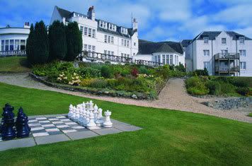 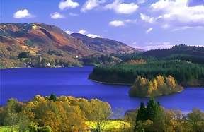
|
|
|
|
Post by andi on Feb 20, 2007 0:23:51 GMT 10
Balquhidder  Balquhidder Glen extends westwards for 12 miles from the main A84 at a point a little south of Lochearnhead. It is a true cul-de-sac, with its western end concluding in the complex mountainous country north of Loch Katrine and south of Ben More. The first problem for visitors is simply finding the Glen. To reach it you need to turn off the A84 not to the west, but to the east, at the Kingshouse Hotel. From here the road leads past a superb old signpost that predates the upgrading of the A84, through an underpass beneath the "new" road, and out into the Glen itself. The Kingshouse Hotel was built in 1779, for the sum of £40. Today it offers a range of accommodation in the hotel or in nearby lodges, as well as food and drink for the weary traveller. The heyday of this end of the Glen can probably be dated quite precisely: from 1870 to 1965. During this time the Callander & Oban railway passed on a line parallel with the modern A84, and there was a station at Balquhidder Station, a mile north of the Kingshouse Hotel. It is hard today to imagine this as the site of an engine shed, two signal boxes, and a junction on the minor line to Crieff: but it was. From the A84 underpass, the Balquhidder Glen road leads you down to the village of Balquhidder itself. This is the main settlement in the Glen and is primarily know as the location of Balquhidder Kirk. Here, close by the ruins of the Old Kirk, is the last resting place of Rob Roy, who died in 1734. Here too lie his wife and two of their sons. The Rob Roy connection is celebrated by the 79 mile Rob Roy Way which passes nearby on its route from Drymen to Pitlochry. Balquhidder also lies on route of the Coast to Coast Walk from Oban to St Andrews which comes over the hills to the north from Glen Dochart. West of Balquhidder the twisting single track road makes its way along the north shore of Loch Voil and Loch Doine beyond it. Where the two meet you pass Monachyle Mhor Hotel, now one of the major attractions in the Glen, with its hotel and self catering accommodation, and its restaurant. beyond the Monachyle Mhor the Glen takes on a wilder look before the public road eventually comes to a halt at a small car park. From here paths lead out to the surrounding mountains; and especially to Stob Binnein and beyond it Ben More to the north. From the end of the public road a track leads on to Inverlochlarig, which your OS map will tell you is on the site of Rob Roy's House. And as you stand in this lonely spot 12 miles from the A84 junction you begin to appreciate the reason for the name Balquhidder. It comes from the Gaelic "Baile-chuil-tir" which means the distant farm. 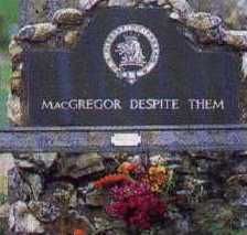 www.undiscoveredscotland.co.uk/balquhidder/balquhidderglen/index.html www.undiscoveredscotland.co.uk/balquhidder/balquhidderglen/index.html
|
|
|
|
Post by neil6147 on May 12, 2007 20:52:13 GMT 10
Rock fall forces closure of road
Falling rock from a historic hill in Stirling has forced the closure of a main road.
Stirling Council are carrying out safety checks on the Abbey Craig, the hill on which the National Wallace Monument stands.
The A907 from Causewayhead Roundabout to Manor Powis Roundabout was closed on Thursday night and will remain shut until safety checks are carried out.
A spokesperson for Stirling Council said the rock fall had been contained.
She added that a detailed inspection of safety fences would be carried out yesterday (Friday).
The road diversions will remain in place until further notice.
|
|
|
|
Post by smudger on May 18, 2007 18:03:12 GMT 10
Thanks , for the up to date info Neil , i know the area very well .
|
|
|
|
Post by neil6147 on May 18, 2007 20:52:04 GMT 10
Have not heard if the road is open again or not.
|
|
|
|
Post by smudger on May 31, 2007 7:16:20 GMT 10
Hope it is , cheers for the up to date info ...very much appreciated .
|
|